Bold Nebraska’s Mary Anne Andrei reports on the risks to Nebraska’s water, and the State Department’s final environmental impact statement (FEIS) for the proposed Keystone XL pipeline.*
Not only does the State Department environmental assessment acknowledge that the proposed Keystone XL pipeline route continues to cross the Sandhills and the Ogallala Aquifer, it also confirms what Nebraska farmers and ranchers have known all along—that toxic chemicals could be transmitted through the loose soils of the Sandhills and the alluvial soils of the Plate Valley at a rapid rate. That’s no surprise to farmers and ranchers who are out there every day and have been for generations. They know Nebraska’s water, and they know its soil. And they understand how precious this resource is to Nebraska and the nation if we intend to protect our agricultural heritage. We’re just glad to see that the State Department knows this too.
The report acknowledges, “the Ogallala Formation and associated alluvial aquifers are a primary source of groundwater for agricultural, domestic, commercial/industrial, and potable use along much of the proposed Project area in southern South Dakota and Nebraska” (3.3-10). And: “Transmissivity of the Ogallala Formation in the Project corridor typically ranges from approximately 2,000 to 10,000 square feet per day” (3.3-10). In other words, contaminants can move through the aquifer risking water resources that are critical to all phases of Nebraskans’ lives and livelihoods.
More than that, the report says that in the Sand Hills, “localized preferential flow paths do exist that could enable dissolved chemicals to move at an increased rate through the unsaturated zone to the water table.” (3.3-29). In other words, these preferential flow paths that exist in the Sandhills and the Platte River Valley would allow contamainents to move down toward the ground water relatively quickly.
The State Department maps (3.3-2-2, 2-3, and 2-4) plot all of the wells within one mile of the proposed Keystone XL pipeline route, including “A total of 14 private water wells… located within approximately 100 feet of the proposed Project corridor within Antelope, Polk, York, Fillmore, and Jefferson counties” (3.3-29). The report tallies 88 miles in Nebraska with nearly 2,400 wells that fit that category. Additionally, the report states that the average depth of the aquifer through the 72 miles of the Sandhills is 20 feet; and 5 feet through the 16 miles of the Platte Valley Unit. The reason that they are looking at wells within one mile of the pipeline is that they are at risk of quickly being contaminated. And in places where the aquifer is shallow or overlaid by surface water, contaminants could spread to our creeks and rivers as well.
Compare the number of wells within one mile of the route in other states:
Montana: 523 wells
South Dakota: 105 wells
***Nebraska: 2,398 wells***
Nearly half of those wells in Nebraska are believed by the State Department to be “shallow” or “very shallow.” That’s 1,100 wells, along nearly one-third of the route in Nebraska, that could be contaminated in a matter of hours. That’s why Nebraskans are up in arms.
Although the State Department report lists propabilities for the liklihood of spills and leaks from Keystone XL, the report is misleading. Consider these facts. KXL purportedly would carry 835,000 barrels of crude per day. TransCanada’s safety system is touted as accurately monitoring the flow of bitumen through the pipeline to 99 percent, which means that 1%, or 8,350 barrels per day could potentially leak without the system detecting it. That is 350,000 gallons per day leaching toxic chemicals into our soil and water.
Think that possibility is remote? Consider these major tar-sands pipeline spills in the United States since 2010:
- July 26, 2010—Marshall, Michigan, Enbridge Line 6B ruptured and spilled 1.4 million gallons of tar sands into the Kalamazoo River. The spill was detected after days of citizen complaints, not by the company’s safety system.
- May 11, 2011—Near Brampton, South Dakota, a farmer spotted a 60-foot geyser of oil shooting from TransCanada’s Keystone 1 pipeline, spilling 21,000 gallons of tar sands crude. The company admits it was still trying to understand why there had been a drop in their pipeline pressure when the landowner called.
- July 26, 2012—Grand Marsh, Wisconsin, Enbridge Line 14 ruptured and spilled 42,000 gallons. It was not detected by the safety system but by a farmer.
- March 29, 2013—Mayflower, Arkansas, Exxon Pegasus Pipeline ruptured and spilled 250,000 gallons of tar sands in the surrounding neighborhood and Lake Conway. The spill was not detected by the safety system but was reported at 2:45 PM by a homeowner. Exxon crews did not arrive to assist local responders until the next morning.
- September 29, 2013—Near Tioga, North Dakota, a Tesoro pipeline ruptured and spilled about 900,000 gallons of tar sands. It was not detected by the safety system but by a landowner while harvesting his wheat crop.

Shannon and Kevin Graves stand in front of the Graves family home built in Nebraska in 1876. The proposed KXL pipeline route runs 275 feet east of the house—480 feet from their domestic well, and 165 feet from one of the four irrigation wells on 400 acres of family farmland. (Photo by Mary Anne Andrei)
Spills like the one that occurred in Marshall, Michigan, underscore the importance of protecting surface water. (Enbridge Line 6B ruptured under a pond that flooded into Talmadge Creek and finally into the Kalamazoo River.) And yet the State Department report does not adequately address surface water concerns in Nebraska.
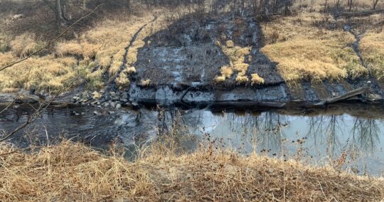
In 2011, University of Nebraska-Lincoln scientists Dr. John Woldt and Dr. Wayne Gates urged the State Department to consider “the abundant interaction between groundwater and surface water” in Nebraska. Because lakes and streams in the Sandhills are fed “almost exclusively by groundwater,” they wrote, “risks are not limited to the aquifer, but extend to surface water as well.”
Although the State Department report acknowledges that there “are 281 waterbody crossings along the proposed Project route in Nebraska, including 31 perennial streams, 237 intermittent streams, eight canals, and five artificial or natural lakes, ponds, or reservoirs,” only five rivers in Nebraska would be crossed using horizontal directional drill construction—the safest method for crossing waterways (3.3-43).
Highly sensitive bodies of water like Verdigre Creek, one of the only trout streams in Nebraska, will not be afforded special crossing consideration. Both the Nebraska Game and Parks and Trout Unlimited have called for the crossing of this watershed to be avoided—or at the very least crossed using horizontal directional drilling—but the State Department report does not address this risk at all.
The report acknowledges that floodplains are highly sensitive ecosystems and that, “actions by federal agencies are to avoid to the extent possible the long- and short-term adverse impacts associated with the occupancy and modification of floodplain development wherever there is a practicable alternative” (3.3.4). And yet the proposed route “crosses 12 floodplains in Montana, while four are crossed in South Dakota, and 74 are crossed in Nebraska.” Most significantly, “Pump Station 24 in Nance County Nebraska may be inaccessible during periods of flood” (3.3-50).
Given the acknowledged threat to floodplain ecosystems, the report concludes, “The U.S. Department of the Interior (DOI), through the National Wild and Scenic River System, has a duty to protect designated river environments. The DOI has noted several potential impacts due to floodplain activities of the proposed Project.” But recommends only that “National Park Service criteria relating to Wild and Scenic Rivers be considered when designing crossings of tributaries to and upstream of the Niobrara National Scenic River and Missouri National Recreational River segments” (3.3.4).
Although the State Department report does not adequately address risks to Nebraska’s surface water and the surrounding fragile floodplain ecosystems, the report does confirm what Nebraska farmers and ranchers have been saying all along—that Keystone XL is an unnecessary and unwanted threat to our water and our way of life. As Randy Thompson says, “Keystone XL is all risk, no reward.” If you take the time to read the State Department report, you’ll see just how big that risk really is.
*This report was updated and corrected to reflect data provided by Dr. John Stansbury at the University of Nebraska-Lincoln. To better understand the probability of a Keystone XL spill, please read his report, “Analysis of Frequency, Magnitude and Consequence of Worst-Case spills from the Proposed Keystone XL Pipeline.”