On July 25th, Nebraskans will stand with the citizens who experienced America’s worst inland oil spill. Two years ago, a Canadian tarsands company Enbridge had a rupture in their pipeline. The spill has cost $725 million dollars so far to “clean-up” and families are still picking up the pieces.
Last year, Ben traveled to the spill site, you can see a video and read more about what he saw and learned.
About the “We Are Nebraska, We Are Kalamazoo, Keep Our Water Blue” Event:
The “We Are the Kalamazoo” actions across the United States and today in Nebraska represent national unity with our neighbors in Michigan who continue to be negatively affected by a dirty tarsands spill that occurred two years ago and continues to leave pollution in the Kalamazoo river.
The Nebraska event, on July 25th at 1pm, is being held in front of Gov. Heineman’s mansion because he has made remarks that he does not think the pipeline should cross the Ogallala Aquifer and it still does. Further, the federal regulators (NTSB) who reviewed the causes of the Kalamazoo tarsands spill found that one of the main reasons it happened was lax oversight and gross incompetence. Nebraskans are justified in our concerns and want to know from Gov. Heineman who will “keep our water blue” since even the DEQ has recently said they have no authority to re-route the pipeline away from fragile soil and critical bodies of water.
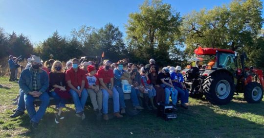
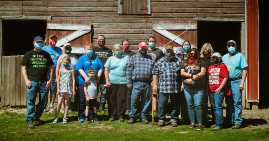
A poster of pictures gathered from Nebraskans statewide will be on display at the event on July 25th at 1pm in Lincoln. The pictures can also be seen on Bold’s Facebook page.
About the Kalamazoo Spill:
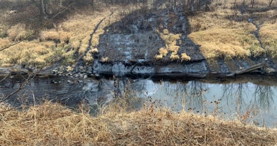
- The Kalamazoo spill, which occurred on July 25, 2010 near Marshall, Michigan, is the largest inland oil spill in the history of the United States.
- The pipeline operated by Enbridge Inc. spilled approximately 1.2 million gallons of tar sands diluted bitumen (dilbit) into a wetland that overflowed into the Kalamazoo River, contaminating nearly 40 miles of the watershed.
- Now, 2 years later, the spill clean-up is still not completed and the total cost of the spill (currently at $725 million) has made it the costliest in U.S. history.
- Much of the difficulty in clean-up has arisen because of the nature of tar sands oil. Tar sands oil is heavier than conventional crude, and therefore travels through the pipelines under high pressure as diluted bitumen (tar sands oil mixed with chemical dilutents for transport). When the diluted tar sands bitumen leaks the chemicals separate and the tar sands oil sinks in water while the high pressure increases the volume of tar sands oil leaked when there is a spill.
Voices of Reason:
“My family was directly impacted by the spill. The toxic fumes gave us rashes, nausea and headaches. By taking a stand against tar sands we are fighting for people’s rights and health. Our River will never fully recover, but we can educate the country about the dangers of tar sands and the disastrous impact this type of spill can have so the same thing doesn’t happen to you.” – Susan Connolly, mother, impacted by the Enbridge spill, sconnolly714@gmail.com, 269-830-6957
“Increased capacity for tar sands oil is not what we need in the face of dangerous climate change. Tarsands does not fit in the new energy economy and is the wrong direction for America. The proliferation of tar sands pipeline projects only means more chances of toxic tar sands oil spills happening more frequently and we certainly don’t want a bunch of bumbling ‘Keystone Kops’ in charge of keeping our drinking water clean.” -Anthony Swift, an attorney for NRDC’s International Program, aswift@nrdc.org, 202-513-6276
Press and Citizen Resources:
Nebraska photos taken by citizens with water at-risk from TransCanada’s proposed pipeline. All photos can be used for print or TV: http://tinyurl.com/keepwaterblue
National Wildlife Federation report on dangers of the tarsands spill in the Kalamazoo and the red flags for future pipelines.
Tarsands, how it is different than convention oil: http://insideclimatenews.org/print/15521
Bold worked with a professional map creator to develop a map that shows the TransCanada Keystone XL pipeline still crossing fragile sandy soil and the Ogallala Aquifer. The map was reviewed by professor, Dr. Gates: https://boldnebraska.org/map_risks
Video from spill site last year: https://boldnebraska.org/kalamazoo_cover_up/
Need additional info? Contact Jane Kleeb, 402-705-3622, jane@boldnebraska.org